Your cart
There are no more items in your cart


UgCS ENTERPRISE License
UGCS ENTER PERPETU
* 1 Days - 19 H Spain.. Other country Ask Sales Dep.
€2,650.00
Tax included
* 1 Days - 19 H Spain.. Other country Ask Sales Dep.
To order this product please contact: industrial@djiarsmadrid.com
10% discount on every perpetual license included in the purchase of any Mavic 3 Enterprise
UgCS Pro Perpetual License
UgCS ENTERPRISE perpetual
UgCS ENTERPRISE unlocks the full capability of UgCS, including all the features of UgCS PRO and EXPERT with the addition of UgCS ENTERPRISE exclusive features such as multi-node deployment and live video streaming.
It is designed for deployment on small and large scale companies employing drone pilots for various purposes such as infrastructure surveillance, security, law enforcement, aerial video monitoring, LiDAR data collection and other purposes. It is also used by professional drone pilots and search and rescue (SAR) teams who require video streaming.
Discover why UgCS ENTERPRISE is the top choice for small and large scale companies using drones.
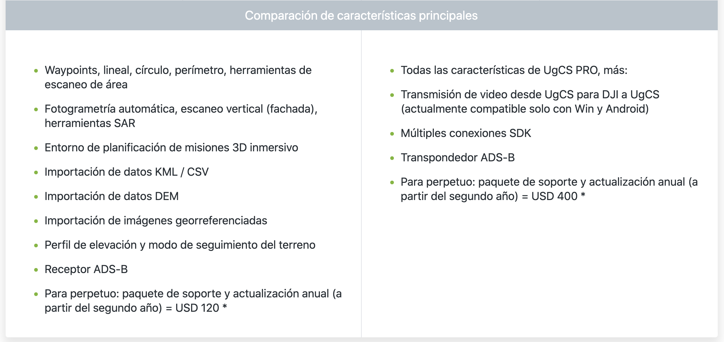
Exclusive features of UgCS ENTERPRISE
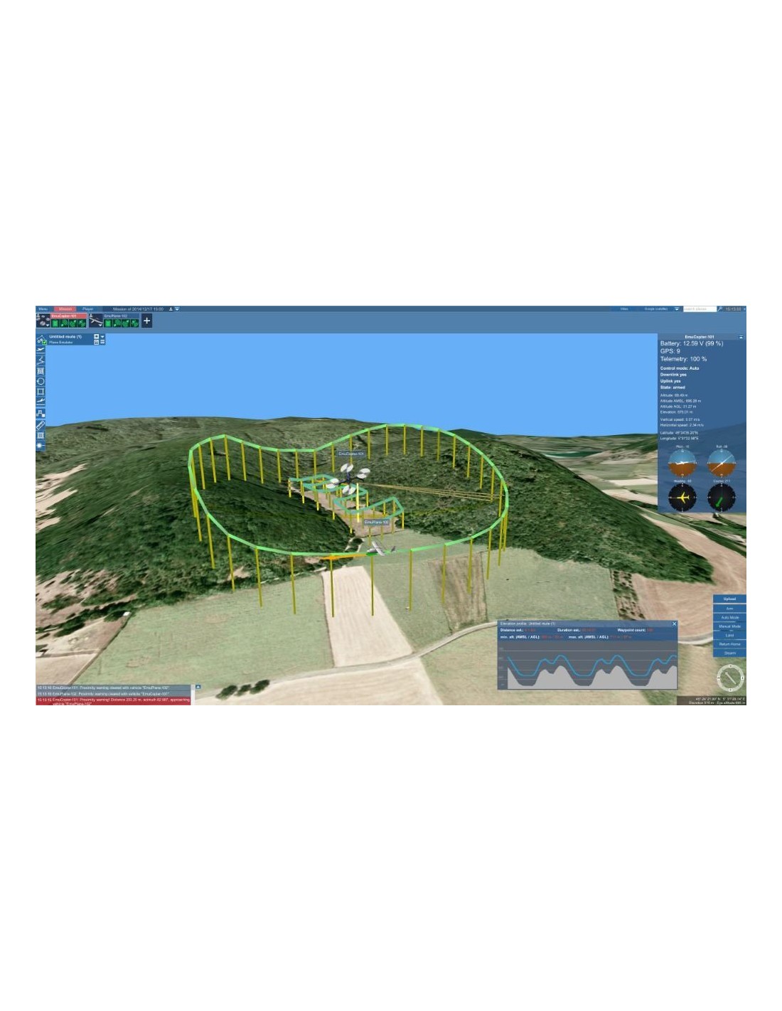
- Run a centralized UgCS telemetry and video server and have pilots from the field connect over a VPN
- Live video streaming from UgCS for DJI to UgCS Video Player on Desktop
- Local video recording embedded metadata (geolocation, timestamp, vehicle ID and other)
- Video live streaming over RTSP to VMS (such as Luxriot, Milestone)
- Multiple SDK connections
- *ADS-B Transponder support
Features of UgCS ENTERPRISE for LiDAR surveys
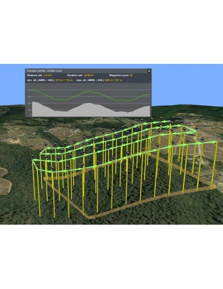
- LiDAR Area and LiDAR Corridor tools
- IMU Calibration route pattern (figure eight)
- IMU Calibration actions (figure eight, U-turn/J-hook)
- LiDAR flight planning based on FOV value
- Adjustable corner radius for smooth cornering
- Loop turns for additional IMU calibration
- Adjustable LiDAR area buffer size
Other features of UgCS ENTERPRISE
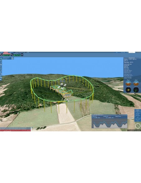
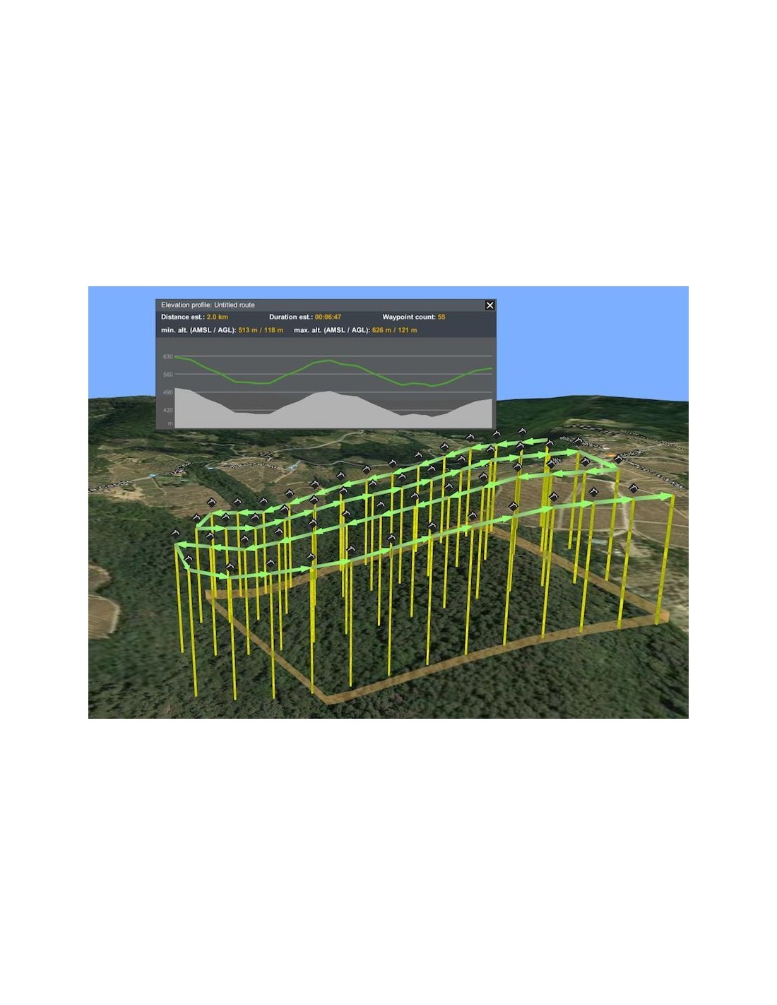
- Plan flights with terrain following
- 3D flight planning interface
- Offline maps (fly without internet connection)
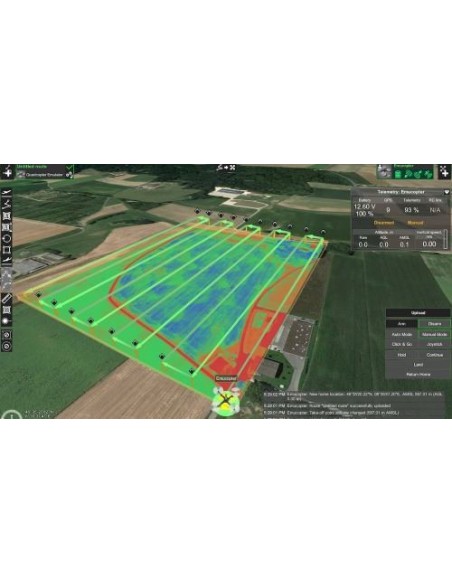
- Photogrammetry, Vertical (Facade) scan, Corridor mapping, SAR, Linear, Circle, Waypoint, Perimeter, Area Scan flight planning tools
- Route import from KML/CSV data
- DEM/DSM elevation data import from .TIF format
- Preview flights with respect to terrain elevation profile
- Automatic telemetry recording
- Geo-referenced image import
- Create custom no-fly zones (NFZ)
- Custom map overlays
- ADS-B Receiver support
- Compatible with UgCS Mapper to process images and create map overlays. Discover »»»
Supported Drones
- UgCS supports most popular UAV platforms including DJI M300, M600, M2X0, Inspire, Phantom series, Mavic series; MAVLink-compatible drones (Pixhawk with ArduPilot/PX4). Discover UgCS supported drones and autopilots »»»
UgCS ENTERPRISE perpetual license
- Buy once, own forever
- First year of support and updates is included
- Starting from the second year, an annual Support & Update pack needs to be purchased to get access to support and the latest updates. More info »»»
Technical details
- Installs locally on your Windows computer
- Android app UgCS for DJI is used to connect to DJI drones
UgCS currently supports DJI: Matrice 300, Matrice 30, Mavic 3 Enterprise, Phantom 4/4 Pro, Phantom 3, Phantom 2, Inspire 2, Inspire 1/1 Pro/Raw, Mavic Pro, A3, N3, Matrice 600/600 Pro, Matrice 200/210/210RTK, Matrice 100, A2, Naza-M v2, WooKong-M, Vision2+, Ace One; Ardupilot, Px4and other MAVLink compatible multirotors, fixed wings and VTOLs; YUNEEC: H520; Mikrokopter; Micropilot; Microdrones; LockheedMartin: Kestrel, Indago.
UGCS SYSTEM REQUIREMENTS
Operating system:
- WINDOWS
- Windows 7 with SP1 or later; Windows 8; Windows 10 / 64-bit
- macOS
- Mac OS X Maverick 10.9 or later / 64-bit
- LINUX
- Ubuntu 16.04 LTS / 64-bit
Graphics hardware
- Graphics card with DirectX 9 support (shader model 2.0). Any card made since 2004 should work
Hard drive
- 2 GB of free space
CPU
- Core 2 Duo or Athlon X2 at 2.4 GHz
Network
- TCP/IPv4 network stack
Memory
- Recommended RAM: 4GB or more
Screen resolution
- Minimum supported screen resolution: 1024x768
Tap to zoom
